Farm Fire Monitoring
2020
I worked as a Researcher with Dr. Pawan Gupta to evaluate the impact of Stubble Burning on PM-2.5 levels.
Problem : Farmers in the state of Punjab and Haryana burn the stubble and this burning leads to high pollution levels from October to January season in Northern India. Currently, only Satellite data is used to monitor these farm fires, but this Satellite data is collected only 2 times during the day, thus limiting its use.
Solution : If authorities have more real-time data on Stubble Bunring and its sites, they can take much more effective action to limit its spread and control it.
1.) Drone Farm Fire Monitoring :
- During our study, for collecting the PM-2.5 data I integrated low-cost Purple Air (Plantower PMS5003) and Alphasense OPC-R1 sensors on a Phantom 4 drone, and flew the drone over a farm fire site that was happening in Karnal district in Haryana, India.

- We observed significant changes in PM-2.5 values before, during and after the fire, with a clear spike in PM-2.5 values observed during the fire. We also tried to compare our results from the sensor integrated on the drone to the data taken by the Satellite at 1:30 pm.


2.) Farm Fire Impact on Villages :
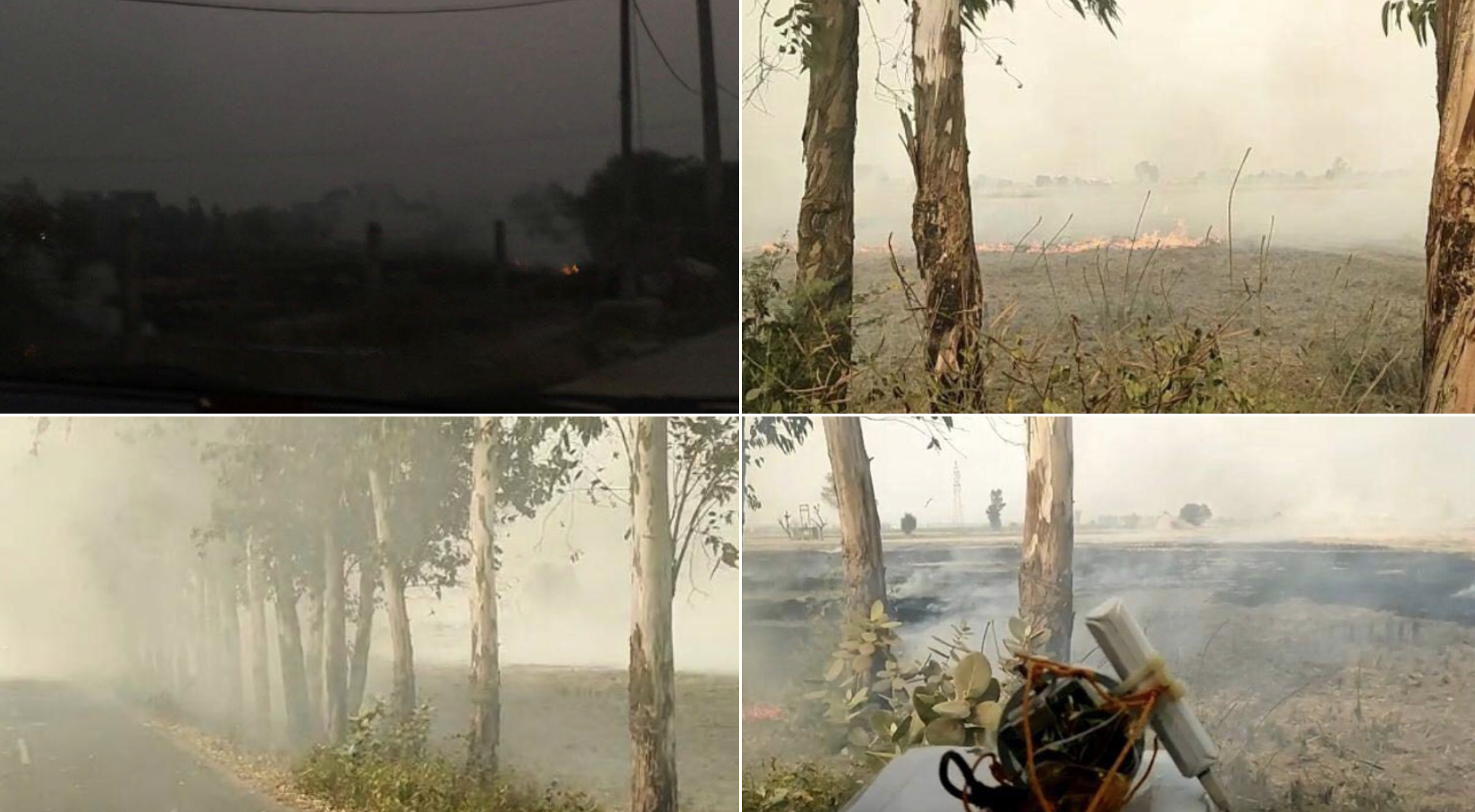
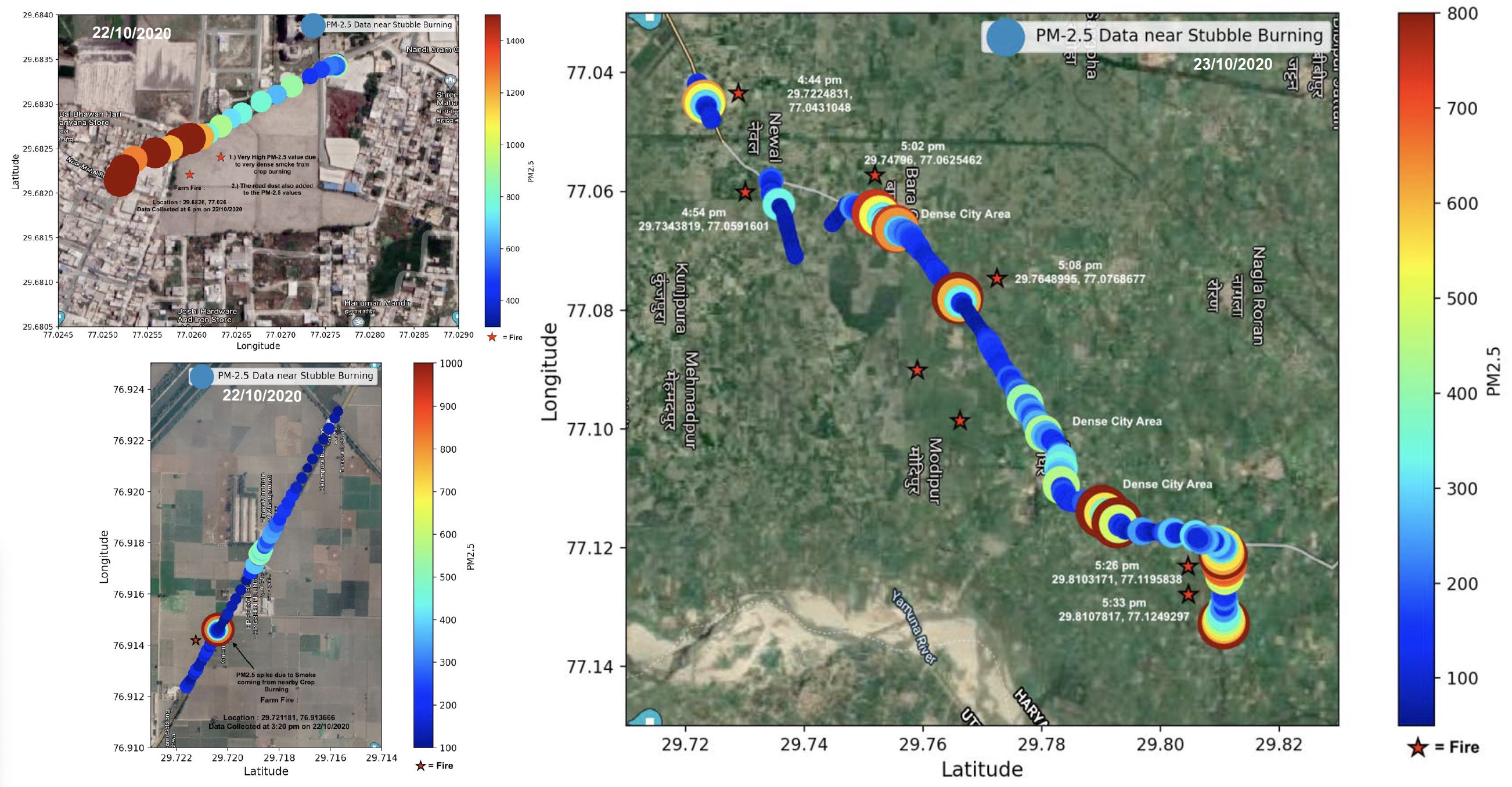
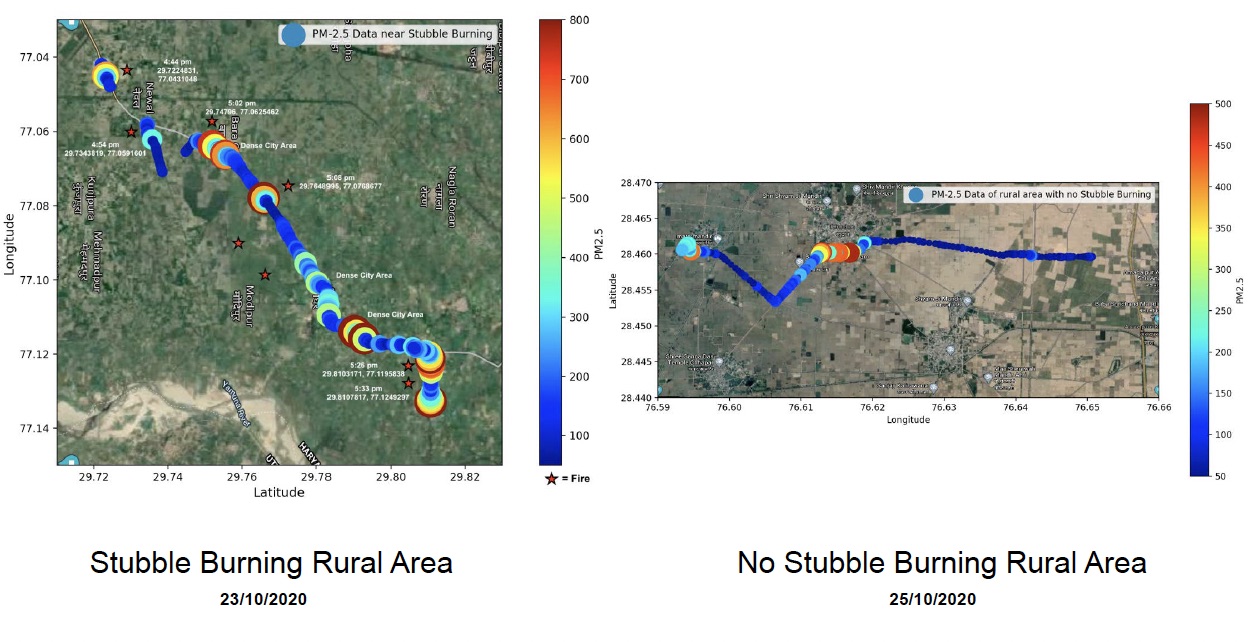
- The impact of stubble burning on the air quality is significant in the nearby villages where stubble is burned. To get more data on this, I went across the villages in Karnal where stubble burning was happening and collected PM2.5 data by performing mobile sensing with the car. The collected data in these rural areas clearly showed a significant spike in PM-2.5 values.


- I also did mobile sensing in rural areas with negligible farm fires and interestingly found that rural areas where farm fires are very frequent, had significantly higher PM-2.5 concentrations, thus showing the impact of farm fires in rural areas.

Project Supervisor : Dr. Pawan Gupta
Work Funded by : Dr. Pawan Gupta and Self Funded
Script 1: Github Repo (storing PM data from Alphasense Optical Particle Counter sensor on Raspberry Pi)
Script 3: Github Repo (storing the real-time data of Purple Air sensor)
Script 4: Github Repo (plotting data on a map)